
Porta topographic map
Interactive map
Click on the map to display elevation.
About this map
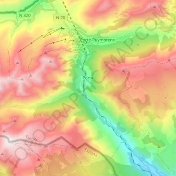
Name: Porta topographic map, elevation, terrain.
Average elevation: 2,089 m
Minimum elevation: 1,262 m
Maximum elevation: 2,907 m
Other topographic maps
Click on a map to view its topography, its elevation and its terrain.
Estoher
Francia > Occitania > Pirineos Orientales > Estoher
Estoher, Prades, Pirineos Orientales, Occitania, Francia metropolitana, 66320, Francia
Average elevation: 1,017 m