
Españita topographic map
Interactive map
Click on the map to display elevation.
About this map
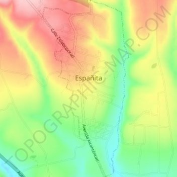
Name: Españita topographic map, elevation, terrain.
Location: Españita, Tlaxcala, México (19.44360 -98.43186 19.47528 -98.41541)
Average elevation: 2,615 m
Minimum elevation: 2,528 m
Maximum elevation: 2,701 m
Other topographic maps
Click on a map to view its topography, its elevation and its terrain.