
Thank you for supporting this site ❤️
Make a donation
Make a donation
Al Jawah topographic map
Click on the map to display elevation.
Thank you for supporting this site ❤️
Make a donation
Make a donation
About this map
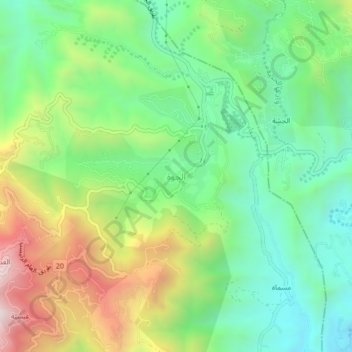
Name: Al Jawah topographic map, elevation, terrain.
Location: Al Jawah, Fayfa, Jazan Province, 23501, Saudi Arabia (17.26077 43.11746 17.30077 43.15746)
Average elevation: 983 m
Minimum elevation: 633 m
Maximum elevation: 1,604 m
Thank you for supporting this site ❤️
Make a donation
Make a donation