
Thank you for supporting this site ❤️
Make a donation
Make a donation
Tarabya Mahallesi topographic map
Click on the map to display elevation.
Thank you for supporting this site ❤️
Make a donation
Make a donation
About this map
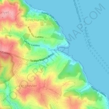
Name: Tarabya Mahallesi topographic map, elevation, terrain.
Location: Tarabya Mahallesi, Sarıyer, Istanbul, Marmara Region, Turkey (41.12703 29.02987 41.14769 29.06407)
Average elevation: 44 m
Minimum elevation: 0 m
Maximum elevation: 129 m
Thank you for supporting this site ❤️
Make a donation
Make a donation