
Las Colmenas topographic map
Click on the map to display elevation.
About this map
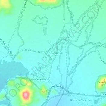
Name: Las Colmenas topographic map, elevation, terrain.
Location: Las Colmenas, Chongoyape, Chiclayo, Lambayeque, Perú (-6.63651 -79.42815 -6.59651 -79.38815)
Average elevation: 230 m
Minimum elevation: 199 m
Maximum elevation: 403 m
Other topographic maps
Click on a map to view its topography, its elevation and its terrain.