
Thank you for supporting this site ❤️
Make a donation
Make a donation
Pangangan Island topographic map
Click on the map to display elevation.
Thank you for supporting this site ❤️
Make a donation
Make a donation
About this map
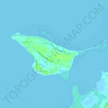
Name: Pangangan Island topographic map, elevation, terrain.
Location: Pangangan Island, Calape, Bohol, Central Visayas, Philippines (9.88800 123.80822 9.90986 123.86282)
Average elevation: 1 m
Minimum elevation: -6 m
Maximum elevation: 11 m
Thank you for supporting this site ❤️
Make a donation
Make a donation
Other topographic maps
Click on a map to view its topography, its elevation and its terrain.