
Tapare Nord topographic map
Interactive map
Click on the map to display elevation.
About this map
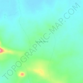
Name: Tapare Nord topographic map, elevation, terrain.
Location: Tapare Nord, Poli, Faro, Région du Nord, Cameroun (8.63984 12.83781 8.67984 12.87781)
Average elevation: 249 m
Minimum elevation: 219 m
Maximum elevation: 354 m
Other topographic maps
Click on a map to view its topography, its elevation and its terrain.
Gode
Cameroun > Région du Nord > Faro > Poli
Gode, Poli, Faro, Région du Nord, Cameroun
Average elevation: 453 m
Ouro Mandara
Cameroun > Région du Nord > Faro > Poli
Ouro Mandara, Poli, Faro, Région du Nord, Cameroun
Average elevation: 356 m