
Thank you for supporting this site ❤️
Make a donation
Make a donation
Dry Creek topographic map
Click on the map to display elevation.
Thank you for supporting this site ❤️
Make a donation
Make a donation
About this map
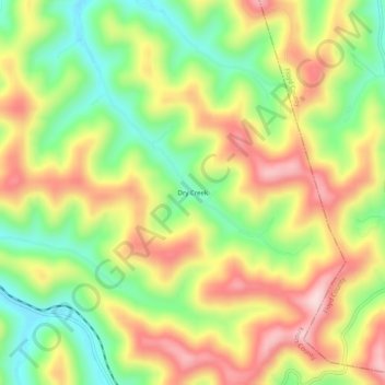
Name: Dry Creek topographic map, elevation, terrain.
Location: Dry Creek, Knott County, Kentucky, 41606, United States (37.30482 -82.78794 37.34482 -82.74794)
Average elevation: 425 m
Minimum elevation: 274 m
Maximum elevation: 589 m
Thank you for supporting this site ❤️
Make a donation
Make a donation
Other topographic maps
Click on a map to view its topography, its elevation and its terrain.