
Thank you for supporting this site ❤️
Make a donation
Make a donation
Lerep topographic map
Click on the map to display elevation.
Thank you for supporting this site ❤️
Make a donation
Make a donation
About this map
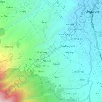
Name: Lerep topographic map, elevation, terrain.
Location: Lerep, Semarang, Central Java, 50511, Indonesia (-7.16464 110.36769 -7.12464 110.40769)
Average elevation: 516 m
Minimum elevation: 303 m
Maximum elevation: 1,292 m
Thank you for supporting this site ❤️
Make a donation
Make a donation
Other topographic maps
Click on a map to view its topography, its elevation and its terrain.