
Thank you for supporting this site ❤️
Make a donation
Make a donation
Hingurana topographic map
Click on the map to display elevation.
Thank you for supporting this site ❤️
Make a donation
Make a donation
About this map
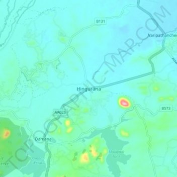
Name: Hingurana topographic map, elevation, terrain.
Location: Hingurana, Ampara District, Eastern Province, Sri Lanka (7.18786 81.63315 7.26786 81.71315)
Average elevation: 39 m
Minimum elevation: 17 m
Maximum elevation: 189 m
Thank you for supporting this site ❤️
Make a donation
Make a donation
Other topographic maps
Click on a map to view its topography, its elevation and its terrain.