
Thank you for supporting this site ❤️
Make a donation
Make a donation
Bolero topographic map
Click on the map to display elevation.
Thank you for supporting this site ❤️
Make a donation
Make a donation
About this map
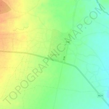
Name: Bolero topographic map, elevation, terrain.
Location: Bolero, Rumphi, Northern Region, Malawi, Malawi (-11.00114 33.72124 -10.96114 33.76124)
Average elevation: 1,098 m
Minimum elevation: 1,080 m
Maximum elevation: 1,117 m
Thank you for supporting this site ❤️
Make a donation
Make a donation