
Thank you for supporting this site ❤️
Make a donation
Make a donation
Câmpulung topographic map
Click on the map to display elevation.
Thank you for supporting this site ❤️
Make a donation
Make a donation
About this map
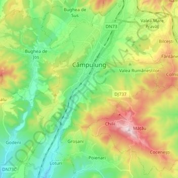
Name: Câmpulung topographic map, elevation, terrain.
Location: Câmpulung, Argeș, Romania (45.20801 24.99521 45.30461 25.10111)
Average elevation: 682 m
Minimum elevation: 501 m
Maximum elevation: 1,011 m
Thank you for supporting this site ❤️
Make a donation
Make a donation
Other topographic maps
Click on a map to view its topography, its elevation and its terrain.