
Thank you for supporting this site ❤️
Make a donation
Make a donation
Blooming Grove topographic map
Click on the map to display elevation.
Thank you for supporting this site ❤️
Make a donation
Make a donation
About this map
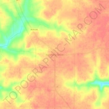
Name: Blooming Grove topographic map, elevation, terrain.
Location: Blooming Grove, Franklin County, Indiana, United States (39.48227 -85.08468 39.52227 -85.04468)
Average elevation: 299 m
Minimum elevation: 254 m
Maximum elevation: 317 m
Thank you for supporting this site ❤️
Make a donation
Make a donation
Other topographic maps
Click on a map to view its topography, its elevation and its terrain.