Geolocate

Cowan topographic map

Click on the map to display elevation.

About this map

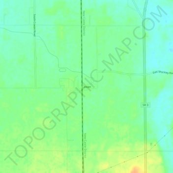
Name: Cowan topographic map, elevation, terrain.

Location: Cowan, Delaware County, Indiana, 47367, United States (40.08588 -85.40858 40.12588 -85.36858)

Average elevation: 303 m

Minimum elevation: 290 m

Maximum elevation: 322 m

Other topographic maps

Click on a map to view its topography, its elevation and its terrain.

Yorktown

United States > Indiana > Delaware County

Average elevation: 282 m

Eaton

United States > Indiana > Delaware County

Average elevation: 279 m

Albany

United States > Indiana > Delaware County

Average elevation: 290 m

White River

United States > Indiana > Delaware County > Yorktown

Average elevation: 282 m

Daleville

United States > Indiana > Delaware County

Average elevation: 280 m

Selma

United States > Indiana > Delaware County

Average elevation: 304 m