
Thank you for supporting this site ❤️
Make a donation
Make a donation
Maurik topographic map
Click on the map to display elevation.
Thank you for supporting this site ❤️
Make a donation
Make a donation
About this map
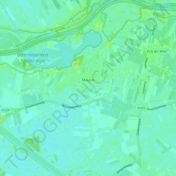
Name: Maurik topographic map, elevation, terrain.
Location: Maurik, Buren, Gelderland, Netherlands (51.93091 5.37583 51.98566 5.45083)
Average elevation: 5 m
Minimum elevation: 1 m
Maximum elevation: 13 m
Thank you for supporting this site ❤️
Make a donation
Make a donation
Other topographic maps
Click on a map to view its topography, its elevation and its terrain.
Thank you for supporting this site ❤️
Make a donation
Make a donation
Thank you for supporting this site ❤️
Make a donation
Make a donation
Thank you for supporting this site ❤️
Make a donation
Make a donation
Thank you for supporting this site ❤️
Make a donation
Make a donation