
La Vedrenne topographic map
Interactive map
Click on the map to display elevation.
About this map
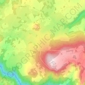
Name: La Vedrenne topographic map, elevation, terrain.
Average elevation: 650 m
Minimum elevation: 411 m
Maximum elevation: 854 m
Other topographic maps
Click on a map to view its topography, its elevation and its terrain.
Vaux
France > Nouvelle-Aquitaine > Corrèze > Sarroux - Saint-Julien > Saint-Julien-près-Bort > Vaux
Vaux, Saint-Julien-près-Bort, Sarroux - Saint-Julien, Ussel, Corrèze, Nouvelle-Aquitaine, France métropolitaine, 19110, France
Average elevation: 652 m