
Thank you for supporting this site ❤️
Make a donation
Make a donation
Cenggerengan topographic map
Click on the map to display elevation.
Thank you for supporting this site ❤️
Make a donation
Make a donation
About this map
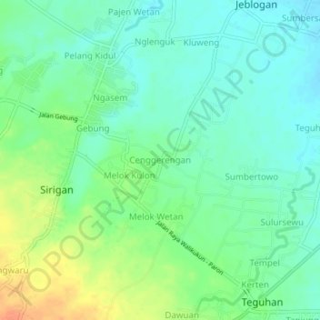
Name: Cenggerengan topographic map, elevation, terrain.
Location: Cenggerengan, Ngawi, East Java, Java, Indonesia (-7.47805 111.31078 -7.43805 111.35078)
Average elevation: 79 m
Minimum elevation: 65 m
Maximum elevation: 105 m
Thank you for supporting this site ❤️
Make a donation
Make a donation