
Thank you for supporting this site ❤️
Make a donation
Make a donation
Corkery topographic map
Click on the map to display elevation.
Thank you for supporting this site ❤️
Make a donation
Make a donation
About this map
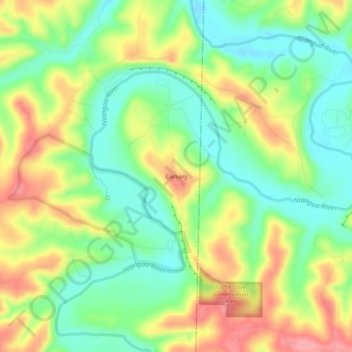
Name: Corkery topographic map, elevation, terrain.
Location: Corkery, Dallas County, Missouri, United States (37.77532 -92.88129 37.81532 -92.84129)
Average elevation: 281 m
Minimum elevation: 238 m
Maximum elevation: 338 m
Thank you for supporting this site ❤️
Make a donation
Make a donation
Other topographic maps
Click on a map to view its topography, its elevation and its terrain.