
West End topographic map
Interactive map
Click on the map to display elevation.
About this map
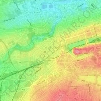
Name: West End topographic map, elevation, terrain.
Location: West End, City of Edinburgh, Scotland, United Kingdom (55.94265 -3.22936 55.95523 -3.20297)
Average elevation: 59 m
Minimum elevation: 11 m
Maximum elevation: 110 m
Other topographic maps
Click on a map to view its topography, its elevation and its terrain.
West Clifton
United Kingdom > Scotland > City of Edinburgh
West Clifton, City of Edinburgh, Scotland, EH53 0PN, United Kingdom
Average elevation: 93 m