
Thank you for supporting this site ❤️
Make a donation
Make a donation
Sungai Bintang topographic map
Click on the map to display elevation.
Thank you for supporting this site ❤️
Make a donation
Make a donation
About this map
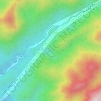
Name: Sungai Bintang topographic map, elevation, terrain.
Location: Sungai Bintang, Kulim, Kedah, Malaysia (5.33799 100.83502 5.34257 100.84332)
Average elevation: 405 m
Minimum elevation: 192 m
Maximum elevation: 740 m
Thank you for supporting this site ❤️
Make a donation
Make a donation
Other topographic maps
Click on a map to view its topography, its elevation and its terrain.