
Thank you for supporting this site ❤️
Make a donation
Make a donation
Gourdon topographic map
Click on the map to display elevation.
Thank you for supporting this site ❤️
Make a donation
Make a donation
About this map
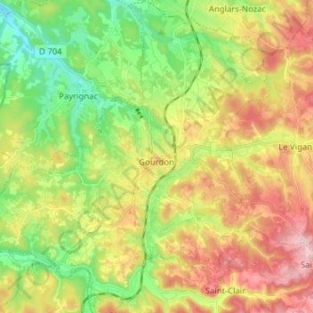
Name: Gourdon topographic map, elevation, terrain.
Location: Gourdon, Lot, Occitania, Metropolitan France, 46300, France (44.69314 1.31333 44.78358 1.42918)
Average elevation: 215 m
Minimum elevation: 98 m
Maximum elevation: 367 m
Thank you for supporting this site ❤️
Make a donation
Make a donation