
Thank you for supporting this site ❤️
Make a donation
Make a donation
Krokstadøra topographic map
Click on the map to display elevation.
Thank you for supporting this site ❤️
Make a donation
Make a donation
About this map
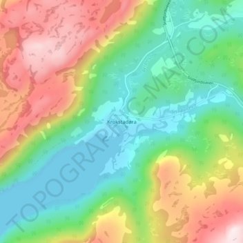
Name: Krokstadøra topographic map, elevation, terrain.
Location: Krokstadøra, Orkland, Trøndelag, Norway (63.37937 9.48077 63.41937 9.52077)
Average elevation: 209 m
Minimum elevation: 0 m
Maximum elevation: 562 m
Thank you for supporting this site ❤️
Make a donation
Make a donation
Other topographic maps
Click on a map to view its topography, its elevation and its terrain.