
Thank you for supporting this site ❤️
Make a donation
Make a donation
Perkins topographic map
Click on the map to display elevation.
Thank you for supporting this site ❤️
Make a donation
Make a donation
About this map
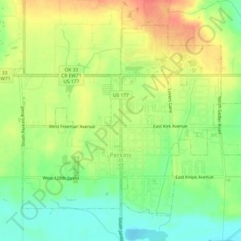
Name: Perkins topographic map, elevation, terrain.
Location: Perkins, Payne County, Oklahoma, 74059, United States (35.96540 -97.05254 35.99261 -97.01007)
Average elevation: 275 m
Minimum elevation: 249 m
Maximum elevation: 301 m
Thank you for supporting this site ❤️
Make a donation
Make a donation
Other topographic maps
Click on a map to view its topography, its elevation and its terrain.