
Thank you for supporting this site ❤️
Make a donation
Make a donation
Hodeidah topographic map
Click on the map to display elevation.
Thank you for supporting this site ❤️
Make a donation
Make a donation
Hodeidah
Mountain Highlands: Notable mountains include Jabal Ras and Jabal Bura, both reaching elevations of 2,000 to 2,400 meters above sea level.
Thank you for supporting this site ❤️
Make a donation
Make a donation
About this map
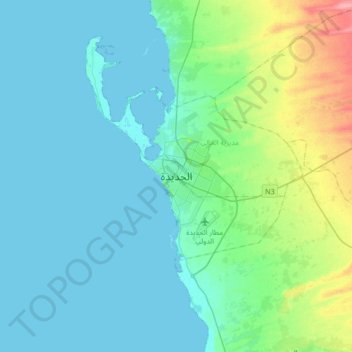
Name: Hodeidah topographic map, elevation, terrain.
Location: Hodeidah, Al Hali District, Al Hudaydah Governorate, Yemen (14.63787 42.79449 14.95787 43.11449)
Average elevation: 16 m
Minimum elevation: -3 m
Maximum elevation: 91 m
Thank you for supporting this site ❤️
Make a donation
Make a donation
Other topographic maps
Click on a map to view its topography, its elevation and its terrain.
Thank you for supporting this site ❤️
Make a donation
Make a donation
Thank you for supporting this site ❤️
Make a donation
Make a donation
Thank you for supporting this site ❤️
Make a donation
Make a donation