
Hara topographic map
Click on the map to display elevation.
About this map
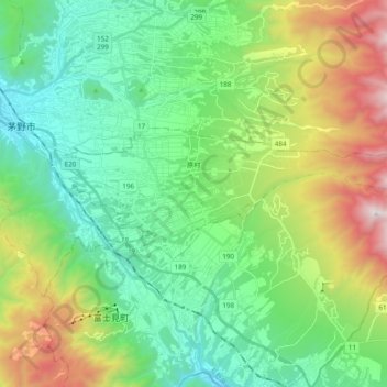
Name: Hara topographic map, elevation, terrain.
Location: Hara, Suwa County, Nagano Prefecture, 391-0104, Japan (35.93139 138.17726 35.98467 138.37046)
Average elevation: 1,235 m
Minimum elevation: 760 m
Maximum elevation: 2,370 m