
Thank you for supporting this site ❤️
Make a donation
Make a donation
El Terminillo topographic map
Click on the map to display elevation.
Thank you for supporting this site ❤️
Make a donation
Make a donation
About this map
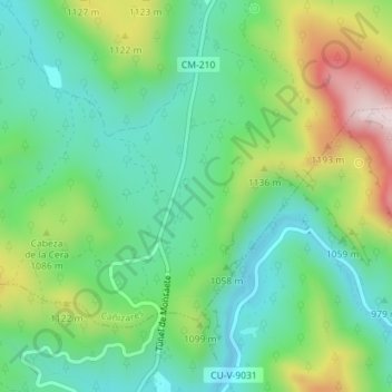
Name: El Terminillo topographic map, elevation, terrain.
Location: El Terminillo, Cañizares, Cuenca, Castile-La Mancha, Spain (40.47446 -2.23228 40.49446 -2.21228)
Average elevation: 1,022 m
Minimum elevation: 889 m
Maximum elevation: 1,297 m
Thank you for supporting this site ❤️
Make a donation
Make a donation