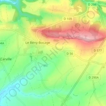
Click on the map to display elevation.
Name: Le Hamel Pin topographic map, elevation, terrain.
Location: Le Hamel Pin, Le Bény-Bocage, Souleuvre-en-Bocage, Vire, Calvados, Normandie, France métropolitaine, 14350, France (48.91273 -0.85062 48.95273 -0.81062)
Average elevation: 157 m
Minimum elevation: 86 m
Maximum elevation: 257 m
Click on a map to view its topography, its elevation and its terrain.
France > Normandie > Calvados > Souleuvre-en-Bocage
Average elevation: 123 m
Average elevation: 229 m
Average elevation: 147 m
France > Normandie > Calvados > Souleuvre-en-Bocage > Montfragon
Average elevation: 149 m
Average elevation: 162 m
Average elevation: 131 m
Average elevation: 185 m
Average elevation: 180 m
Average elevation: 195 m
Average elevation: 113 m