
Estes Park topographic map
Interactive map
Click on the map to display elevation.
About this map
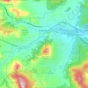
Name: Estes Park topographic map, elevation, terrain.
Average elevation: 2,421 m
Minimum elevation: 2,230 m
Maximum elevation: 2,897 m
Other topographic maps
Click on a map to view its topography, its elevation and its terrain.
Estes Park
Stati Uniti d'America > Colorado > Larimer County > Estes Park
Estes Park, Larimer County, Colorado, Stati Uniti d'America
Average elevation: 2,409 m