Mainling City topographic map
Click on the map to display elevation.
Mainling City
Mainling is located in the central-west of the Nyingtri Prefecture, at the middle reaches of the Yarlung Tsangpo River, and between the Nyenchen Tanglha Mountains and the Himalayan Mountains. It de jure covers an area of 9,490 square kilometres, including the area claimed but de facto under control of the Arunachal Pradesh, India. The average altitude is 3,700 metres above sea level.
About this map
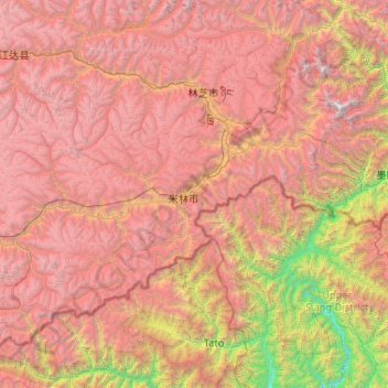
Name: Mainling City topographic map, elevation, terrain.
Location: Mainling City, Nyingchi Prefecture, Xizang, 860000, China (28.65467 93.12770 29.83983 95.20817)
Average elevation: 3,611 m
Minimum elevation: 250 m
Maximum elevation: 7,646 m
Other topographic maps
Click on a map to view its topography, its elevation and its terrain.