
Loreto topographic map
Interactive map
Click on the map to display elevation.
About this map
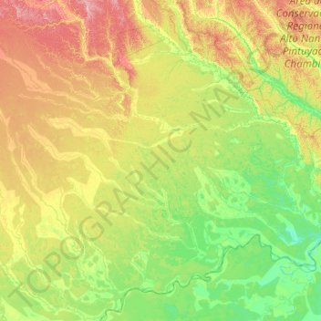
Name: Loreto topographic map, elevation, terrain.
Location: Loreto, Pérou (-5.00000 -76.16667 -3.00000 -74.16667)
Average elevation: 134 m
Minimum elevation: 90 m
Maximum elevation: 273 m
Other topographic maps
Click on a map to view its topography, its elevation and its terrain.
Sonapi
Pérou > Loreto > Teniente César López Rojas
Sonapi, Teniente César López Rojas, Alto Amazonas, Loreto, Pérou
Average elevation: 136 m
Nueva Cajamarca
Pérou > Loreto > Nueva Cajamarca
Nueva Cajamarca, Maynas, Loreto, Pérou
Average elevation: 137 m