
Thank you for supporting this site ❤️
Make a donation
Make a donation
Chocolay Township topographic map
Click on the map to display elevation.
Thank you for supporting this site ❤️
Make a donation
Make a donation
About this map
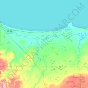
Name: Chocolay Township topographic map, elevation, terrain.
Location: Chocolay Township, Marquette County, Michigan, United States (46.41950 -87.36489 46.50639 -87.11636)
Average elevation: 217 m
Minimum elevation: 176 m
Maximum elevation: 380 m
Thank you for supporting this site ❤️
Make a donation
Make a donation
Other topographic maps
Click on a map to view its topography, its elevation and its terrain.