
Sherborne topographic map
Click on the map to display elevation.
About this map
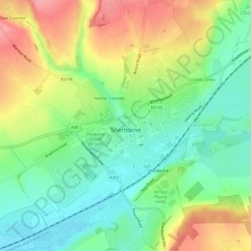
Name: Sherborne topographic map, elevation, terrain.
Location: Sherborne, Dorset, England, United Kingdom (50.93261 -2.54910 50.96580 -2.49910)
Average elevation: 88 m
Minimum elevation: 43 m
Maximum elevation: 152 m
Other topographic maps
Click on a map to view its topography, its elevation and its terrain.