
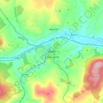
Keith topographic map
Interactive map
Click on the map to display elevation.
About this map
Name: Keith topographic map, elevation, terrain.
Location: Keith, Moray, Scotland, AB55 5FF, United Kingdom (57.50273 -2.99233 57.58273 -2.91233)
Average elevation: 180 m
Minimum elevation: 96 m
Maximum elevation: 364 m
Other topographic maps
Click on a map to view its topography, its elevation and its terrain.
Lossiemouth
United Kingdom > Scotland > Moray
Lossiemouth, Moray, Scotland, IV31 6NU, United Kingdom
Average elevation: 3 m
Findhorn Ecovillage
United Kingdom > Scotland > Moray > Findhorn > Findhorn Ecovillage
Findhorn Ecovillage, Findhorn, Moray, Scotland, IV36 3TZ, United Kingdom
Average elevation: 3 m
Forres
United Kingdom > Scotland > Moray > Forres
Forres, Moray, Scotland, IV36 1NX, United Kingdom
Average elevation: 31 m