
Thank you for supporting this site ❤️
Make a donation
Make a donation
Ankola topographic map
Click on the map to display elevation.
Thank you for supporting this site ❤️
Make a donation
Make a donation
Ankola
Ankola is located at 14°39′38″N 74°18′17″E / 14.66056°N 74.30472°E / 14.66056; 74.30472. It has an average elevation of 17 metres (56 ft). The Gangavali River (also known as Bedti) is a prominent river that flows near the town. Summer temperatures range between 30 and 35 °C (86 and 95 °F) while winter temperatures drop down marginally to between 20 and 33 °C (68 and 91 °F).
Thank you for supporting this site ❤️
Make a donation
Make a donation
About this map
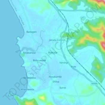
Name: Ankola topographic map, elevation, terrain.
Location: Ankola, Ankola taluk, Uttara Kannada, Karnataka, 581314, India (14.61999 74.26478 14.69999 74.34478)
Average elevation: 27 m
Minimum elevation: -3 m
Maximum elevation: 344 m
Thank you for supporting this site ❤️
Make a donation
Make a donation