
Thank you for supporting this site ❤️
Make a donation
Make a donation
Randolph County topographic map
Click on the map to display elevation.
Thank you for supporting this site ❤️
Make a donation
Make a donation
About this map
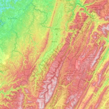
Name: Randolph County topographic map, elevation, terrain.
Location: Randolph County, West Virginia, United States (38.38846 -80.27999 39.11830 -79.34937)
Average elevation: 862 m
Minimum elevation: 322 m
Maximum elevation: 1,473 m
Thank you for supporting this site ❤️
Make a donation
Make a donation
Other topographic maps
Click on a map to view its topography, its elevation and its terrain.