
Thank you for supporting this site ❤️
Make a donation
Make a donation
Friesoythe topographic map
Click on the map to display elevation.
Thank you for supporting this site ❤️
Make a donation
Make a donation
About this map
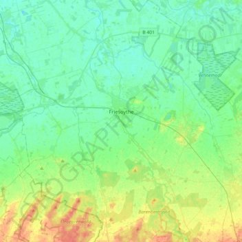
Name: Friesoythe topographic map, elevation, terrain.
Location: Friesoythe, Cloppenburg district, Lower Saxony, 26169, Germany (52.90434 7.70359 53.11977 7.96121)
Average elevation: 13 m
Minimum elevation: 1 m
Maximum elevation: 45 m
Thank you for supporting this site ❤️
Make a donation
Make a donation
Other topographic maps
Click on a map to view its topography, its elevation and its terrain.