
Ramirez topographic map
Click on the map to display elevation.
About this map
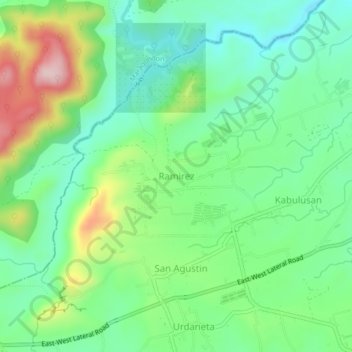
Name: Ramirez topographic map, elevation, terrain.
Location: Ramirez, Magallanes, Cavite, Calabarzon, 4113, Philippines (14.16187 120.71023 14.20187 120.75023)
Average elevation: 190 m
Minimum elevation: 102 m
Maximum elevation: 373 m
Other topographic maps
Click on a map to view its topography, its elevation and its terrain.