
Thank you for supporting this site ❤️
Make a donation
Make a donation
Maisenbach topographic map
Click on the map to display elevation.
Thank you for supporting this site ❤️
Make a donation
Make a donation
About this map
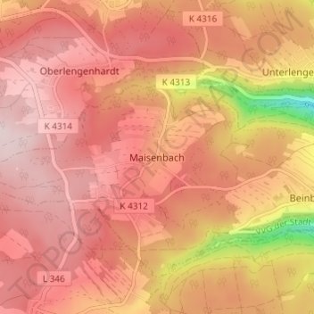
Name: Maisenbach topographic map, elevation, terrain.
Average elevation: 627 m
Minimum elevation: 406 m
Maximum elevation: 720 m
Thank you for supporting this site ❤️
Make a donation
Make a donation
Other topographic maps
Click on a map to view its topography, its elevation and its terrain.
Unterlengenhardt
Germany > Baden-Württemberg > Landkreis Calw > Bad Liebenzell
Average elevation: 510 m