
Bulwer Island topographic map
Interactive map
Click on the map to display elevation.
About this map
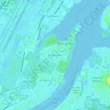
Name: Bulwer Island topographic map, elevation, terrain.
Location: Bulwer Island, Queensland, 4008, Australia (-27.42443 153.11939 -27.38443 153.15939)
Average elevation: 3 m
Minimum elevation: -6 m
Maximum elevation: 23 m
Other topographic maps
Click on a map to view its topography, its elevation and its terrain.
Fort Lytton National Park
Australia > Queensland > Bulwer Island
Fort Lytton National Park, South Street, Caltex Oil Refinery, Lytton, Bulwer Island, Queensland, 4178, Australia
Average elevation: 4 m