
Thank you for supporting this site ❤️
Make a donation
Make a donation
Pyrgos topographic map
Click on the map to display elevation.
Thank you for supporting this site ❤️
Make a donation
Make a donation
About this map
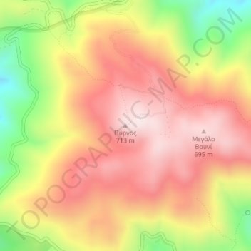
Name: Pyrgos topographic map, elevation, terrain.
Average elevation: 499 m
Minimum elevation: 175 m
Maximum elevation: 718 m
Thank you for supporting this site ❤️
Make a donation
Make a donation
Other topographic maps
Click on a map to view its topography, its elevation and its terrain.
Ios
Greece > Aegean > Thira Regional Unit
The highest elevation (723 m, 2372 ft) is the Kastro (Greek: Κάστρο) peak also called Pyrgos (Greek: Πύργος), located in the center of the island, while around the Kastro are the next three Highest peaks: Xylodema (Greek: Ξυλόδεμα) (660 m, 2165 ft), Kostiza (Greek: Κοστίζα) (586 m,…
Average elevation: 73 m
Thank you for supporting this site ❤️
Make a donation
Make a donation
Nea Kameni
Greece > Aegean > Thira Regional Unit > Thira Municipal Unit > Fira
Average elevation: 16 m