
Thank you for supporting this site ❤️
Make a donation
Make a donation
Ranchester topographic map
Click on the map to display elevation.
Thank you for supporting this site ❤️
Make a donation
Make a donation
About this map
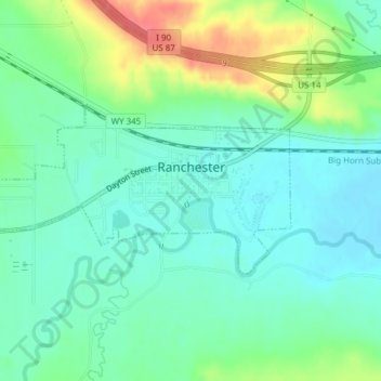
Name: Ranchester topographic map, elevation, terrain.
Location: Ranchester, Sheridan County, Wyoming, 82839, United States (44.90131 -107.18559 44.91300 -107.15341)
Average elevation: 1,159 m
Minimum elevation: 1,138 m
Maximum elevation: 1,207 m
Thank you for supporting this site ❤️
Make a donation
Make a donation