
Thank you for supporting this site ❤️
Make a donation
Make a donation
Plaines Wilhems topographic map
Click on the map to display elevation.
Thank you for supporting this site ❤️
Make a donation
Make a donation
About this map
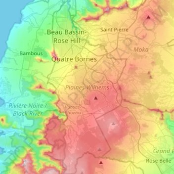
Name: Plaines Wilhems topographic map, elevation, terrain.
Location: Plaines Wilhems, Mauritius (-20.42155 57.43706 -20.18545 57.55680)
Average elevation: 343 m
Minimum elevation: 0 m
Maximum elevation: 806 m
Thank you for supporting this site ❤️
Make a donation
Make a donation