
Chư Păh topographic map
Interactive map
Click on the map to display elevation.
About this map
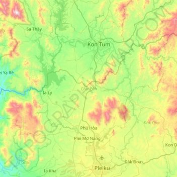
Name: Chư Păh topographic map, elevation, terrain.
Location: Chư Păh, Gia Lai, Vietnam (14.05175 107.65796 14.39228 108.23252)
Average elevation: 696 m
Minimum elevation: 238 m
Maximum elevation: 1,758 m
Other topographic maps
Click on a map to view its topography, its elevation and its terrain.