
Thank you for supporting this site ❤️
Make a donation
Make a donation
Mogollon Rim topographic map
Click on the map to display elevation.
Thank you for supporting this site ❤️
Make a donation
Make a donation
About this map
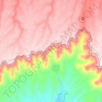
Name: Mogollon Rim topographic map, elevation, terrain.
Location: Mogollon Rim, Rim Road, Coconino County, Arizona, USA (34.42672 -111.31086 34.45339 -111.23973)
Average elevation: 2,108 m
Minimum elevation: 1,727 m
Maximum elevation: 2,338 m
Thank you for supporting this site ❤️
Make a donation
Make a donation
Other topographic maps
Click on a map to view its topography, its elevation and its terrain.