
Thank you for supporting this site ❤️
Make a donation
Make a donation
Datta Mandir topographic map
Click on the map to display elevation.
Thank you for supporting this site ❤️
Make a donation
Make a donation
About this map
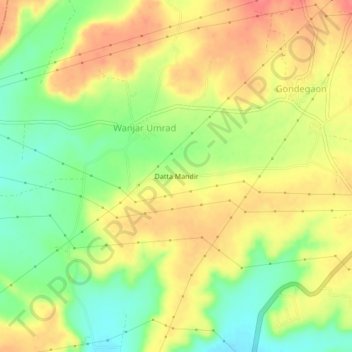
Name: Datta Mandir topographic map, elevation, terrain.
Location: Datta Mandir, Wanjar Umrad, Jalna, Maharashtra, India (19.91300 75.89361 19.95300 75.93361)
Average elevation: 563 m
Minimum elevation: 530 m
Maximum elevation: 591 m
Thank you for supporting this site ❤️
Make a donation
Make a donation