
Gandía topographic map
Interactive map
Click on the map to display elevation.
About this map
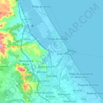
Name: Gandía topographic map, elevation, terrain.
Location: Gandía, La Safor, Valencia, Comunidad Valenciana, España (38.94981 -0.29715 39.04128 -0.14424)
Average elevation: 50 m
Minimum elevation: -2 m
Maximum elevation: 560 m