
Thank you for supporting this site ❤️
Make a donation
Make a donation
San Juan Bautista topographic map
Click on the map to display elevation.
Thank you for supporting this site ❤️
Make a donation
Make a donation
San Juan Bautista
In June 1904, early aviation pioneer John J. Montgomery made a series of successful test flights using his tandem-wing glider in San Juan. This was a prototype to his 1905 gliders that were used to make the first successful high-altitude flights in heavier-than-air flying machines in the world.
Thank you for supporting this site ❤️
Make a donation
Make a donation
About this map
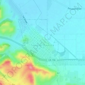
Name: San Juan Bautista topographic map, elevation, terrain.
Average elevation: 72 m
Minimum elevation: 50 m
Maximum elevation: 158 m
Thank you for supporting this site ❤️
Make a donation
Make a donation