
Rußbach am Paß Gschütt topographic map
Interactive map
Click on the map to display elevation.
About this map
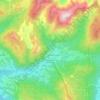
Name: Rußbach am Paß Gschütt topographic map, elevation, terrain.
Average elevation: 1,173 m
Minimum elevation: 669 m
Maximum elevation: 2,017 m
Dörfer: Rußbach am Paß Gschütt • Strubegg | Weiler: Erlbach | Rotten: Bodenberg • Elendgraben • Gseng • Hornegg • Rußbachsaag • Rußegg • Schattau • Schattauhöhe • Triebenegg • Wiesenau | Häusergruppe: Scheiben
Other topographic maps
Click on a map to view its topography, its elevation and its terrain.
Rußbach am Paß Gschütt
Österreich > Salzburg > Rußbach am Paß Gschütt
Rußbach am Paß Gschütt, Hallein, Salzburg, 5442, Österreich
Average elevation: 1,022 m