
Thank you for supporting this site ❤️
Make a donation
Make a donation
Velp topographic map
Click on the map to display elevation.
Thank you for supporting this site ❤️
Make a donation
Make a donation
About this map
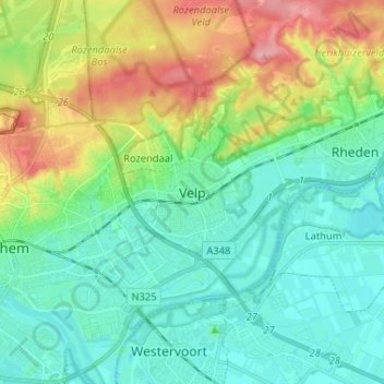
Name: Velp topographic map, elevation, terrain.
Location: Velp, Gelderland, Nederland, 6881HJ, Nederland (51.95587 5.93513 52.03587 6.01513)
Average elevation: 34 m
Minimum elevation: 4 m
Maximum elevation: 106 m
Thank you for supporting this site ❤️
Make a donation
Make a donation