
Thank you for supporting this site ❤️
Make a donation
Make a donation
Klagenfurt topographic map
Click on the map to display elevation.
Thank you for supporting this site ❤️
Make a donation
Make a donation
About this map
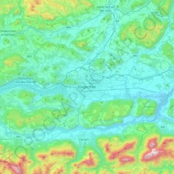
Name: Klagenfurt topographic map, elevation, terrain.
Location: Klagenfurt, Klagenfurt am Wörthersee, Carinthia, 9020, Austria (46.46282 14.14796 46.78282 14.46796)
Average elevation: 681 m
Minimum elevation: 388 m
Maximum elevation: 2,086 m
Thank you for supporting this site ❤️
Make a donation
Make a donation